10-03-21REAL TIME UP TO DATE KILAUEA and MAUNA LOA COVERAGE (as soon as they actually will give us the accurate data and put webcams on Mauna Loa before she blows xox would be soooo lovely 🥰☣️👁🆘⚠️☢️⛔️❤️🔥❤️🔥🥰🥰🌈🌿💥🌋♾

KILAUEA VOLCANO (VNUM #332010)
19°25'16" N 155°17'13" W, Summit Elevation 4091 ft (1247 m)
Current Volcano Alert Level: WARNING
Current Aviation Color Code: RED
19°25'16" N 155°17'13" W, Summit Elevation 4091 ft (1247 m)
Current Volcano Alert Level: WARNING
Current Aviation Color Code: RED
Kīlauea volcano is erupting. Lava continues to erupt from multiple vents along the floor and western wall of Halemaʻumaʻu crater. As of this morning, October 3, 2021, all lava activity is confined within Halemaʻumaʻu in Hawai’i Volcanoes National Park. Seismicity and volcanic gas emission rates remain elevated.
Summit Observations: Sulfur dioxide (SO2) emission rates remain high and were approximately 14,750 tonnes per day on October 2, 2021, which is higher than the previous day. Seismicity is elevated but stable. Summit tiltmeters continue to record deflationary tilt.
Summit Observations: Sulfur dioxide (SO2) emission rates remain high and were approximately 14,750 tonnes per day on October 2, 2021, which is higher than the previous day. Seismicity is elevated but stable. Summit tiltmeters continue to record deflationary tilt.
East Rift Zone Observations: No unusual activity has been noted in the Kīlauea East Rift Zone. SO2 and hydrogen sulfide (H2S) emissions from Puʻuʻōʻō were below instrumental detection levels when last measured on January 7, 2021.
Hazard Analysis: This new eruption at Kīlauea’s summit is occurring within a closed area of Hawai'i Volcanoes National Park. Therefore, high levels of volcanic gas are the primary hazard of concern, as this hazard can have far-reaching effects down-wind. Large amounts of volcanic gas—primarily water vapor (H2O), carbon dioxide (CO2), and sulfur dioxide (SO2)—are continuously released during eruptions of Kīlauea Volcano. As SO2 is released from the summit, it reacts in the atmosphere to create the visible haze known as vog (volcanic smog) that has been observed downwind of Kīlauea. Vog creates the potential for airborne health hazards to residents and visitors, damages agricultural crops and other plants, and affects livestock. For more information on gas hazards at the summit of Kīlauea, please see: https://pubs.er.usgs.gov/publication/fs20173017. Vog information can be found at https://vog.ivhhn.org/.
Additional hazards include Pele's hair and other lightweight volcanic glass fragments from the lava fountains that will fall downwind of the fissure vents and dust the ground within a few hundred meters (yards) of the vent (s). Strong winds may waft lighter particles to greater distances. Residents should minimize exposure to these volcanic particles, which can cause skin and eye irritation.
Other significant hazards also remain around Kīlauea caldera from Halemaʻumaʻu crater wall instability, ground cracking, and rockfalls that can be enhanced by earthquakes within the area closed to the public. This underscores the extremely hazardous nature of Kīlauea caldera rim surrounding Halemaʻumaʻu crater, an area that has been closed to the public since late 2007.


Alert Level: ADVISORY, Color Code: YELLOW2021-09-30 19:55:20
MAUNA LOA VOLCANO (VNUM #332020)
19°28'30" N 155°36'29" W, Summit Elevation 13681 ft (4170 m)
Current Volcano Alert Level: ADVISORY
Current Aviation Color Code: YELLOW
Activity Summary: Mauna Loa Volcano is not erupting. Rates of seismicity at the summit remain slightly above long-term background levels, but have not changed significantly over the past week. Other monitoring data streams—ground deformation, gas discharge, and visual observations—show no significant changes.
Observations:
During the past week, HVO seismometers recorded 69 small-magnitude earthquakes—all below M3.0—beneath the summit and upper-elevation flanks of Mauna Loa. The majority of these earthquakes occurred at shallow depths less than 8 kilometers (5 miles) below sea level.
Measurements of ground deformation, using Global Positioning System (GPS) instruments, confirm that the surface of the volcano has not moved appreciably over the past week.
Gas concentrations and fumarole temperatures at both the summit caldera and at Sulphur Cone on the Southwest Rift Zone remain stable.
Webcam views have shown no changes to the landscape at the Mauna Loa summit or on the lower flanks of the volcano over the past week.
For more information on current monitoring of Mauna Loa Volcano, see: https://www.usgs.gov/volcanoes/mauna-loa/monitoring
Background:
Mauna Loa is the largest active volcano on our planet, rising gradually to 4,170 meters (13,681 feet) above sea level. Its long submarine flanks descend an additional 5 kilometers (3 miles) below sea level to the ocean floor. The ocean floor directly beneath Mauna Loa is, in turn, depressed by the volcano's great mass another 8 kilometres (5 miles). This places Mauna Loa's summit about 17,000 meters (56,000 feet) above its base. The enormous volcano covers half of the Island of Hawaiʻi and by itself amounts to about 85 percent of all the other Hawaiian Islands combined.
Eruptions typically start at the summit and, within minutes to months of eruption onset, about half of the eruptions migrate into either the Northeast or Southwest Rift Zone. Since its first well-documented eruption in 1843, the volcano has erupted 33 times with intervals between eruptions ranging from months to decades. Mauna Loa last erupted in 1984.
Mauna Loa eruptions tend to produce voluminous, fast-moving lava flows that can impact communities on the east and west sides of the Island of Hawaiʻi. Since the mid-19th century, the city of Hilo in east Hawaiʻi has been threatened by seven Mauna Loa lava flows. Mauna Loa lava flows have reached the south and west coasts of the island eight times: in 1859, 1868, 1887, 1926, 1919, and three times in 1950.


Hey guys


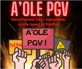
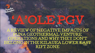
LERZ Puna news blog ESTREETS are buzzin LIKE CRAZY, like the gorgeously amazing , POWERFUL WAVES 🌊 of PELE
WE ARE PUNA
AND
WE ARE WAO KELE O PUNA IS RISING
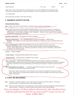
I’m working on your lerz Puna civilian defense broadcast for 10-03-21 (lavadazeday5) , and it will have the ACTUAL DATA FOR LOWER EAST RIFT ZONE LEILANI ESTATES AREAS, WHERE THE 24 ACTIVE KILAUEA PM FISSURES ARE GASSING ALL THE RESIDENTS UNKNOWINGLY, IN THE HOPES TO HELP MY HAWAII RAISE THE AWARENESS NEEDED TO GET ACCURATE AIR QUALITY MONITORING AND FUKIN SEISMIN MONITORING IN THEIR DRILL AREAS.
I KNOW ITS HARD TO UNDERSTAND.
⚠️🆘☢️⚠️🆘☢️⚠️🆘☢️JUST PLEASE HELP.⚠️🆘☢️⚠️🆘☢️⚠️🆘☢️
👁👁SHARE SHARE SHARE 👁👁
🌿♾🔥🌈🪄HAWAII MEEDS TO BREATHE 🌈🪄🔥🌿♾
AND THE WHOLE WORLD REALLY NEEDS TO KNOW WHATS BEHIND IT ALL.
ALOHA
#AWARENESS2021STYLE
PLEASE STAY TUNED,
Posting ALL the current right now ACTUAL REAL LIFE AND NOT IMAGINARY
AIR QUALITY AND SEISMIC DATA/ ERUPTION STATUSES VERY SOON , HERE IN PUNA NEWS 📰 BLOG , from Leilani estates/POHOIKI sacred lands themselves
10-03-21
Gorgeous new pictures and updates, I can’t wait to bring them to you
Check back soon
Peles home
She wants WAO KELE O PUNA to breathe
Jazzy out
Xoxo
Comments
Post a Comment